Originally uploaded by marcopako
Google Earth is a fantastic program which I have been familiar with for a few years now. Living an itinerant life my children have found this program helpful when moving to a new town. They are able to see how far we would be travelling to get to our new destination, where we would be living, what the street looked like, what the town looked like, finding where the pool, the tennis courts and even the school were situated. This actually eased their nervousness about moving.
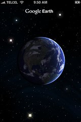
Google Earth is a satellite imagery-based mapping product and according to the creators it places the whole world on a student's computer and brings a world of information alive for students (Google Earth for Educators 2009).
Some of the many different areas where Google Earth could be used:
- Looking at coordinates to demonstrate distance calculations.
- Investigate continents, mountain ranges, dry lakes, major landforms, and volcanic activity.
- Impact of Natural disasters such as the recent bushfires in Victoria.
- Space
- Stargazing
- Ancient cities
- Global warming
Referring back to Dales Cone in relation to active learning Dale (nd) states that the most effective method for active learning involves direct, purposeful learning experiences with hands-on or field experience. Google earth allows students to sit and explore the world at their own pace. They are the navigators of their own exploration therefore they are actively learning.
References
Dale, E., n.d., Active learning online, Why use active learning?, http://www.acu.edu/cte/activelearning/whyuseal2.htm, viewed 20th August, 2009.
Google, 2009, Google for educators, Google earth, google.com/educators/p_earth.html , viewed 20th August, 2009.
No comments:
Post a Comment